Wednesday, February 27, 2013

Lost Atlantis??

Large Zircon Image
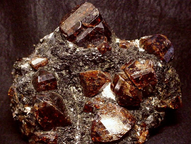
Deep-red natural zircons from Norway
Find below a fascinating article from National Geographic.  It's very relevant to our current study of plate tectonics and volcanoes and also shows how important the field of mineralogy is.


Lion Mountain, in southeast Mauritius.
Lion Mountain (pictured) is located in southeastern Mauritius.
Photograph by Danita Delimont, Alamy
Ker Than
Published February 25, 2013
Evidence of a drowned "microcontinent" has been found in sand grains from the beaches of a small Indian Ocean island, scientists say.
A well-known tourist destination, Mauritius (map) is located about 1,200 miles (2,000 kilometers) off the coast of Africa, east of Madagascar. Scientists think the tiny island formed some nine million years ago from cooling lava spewed by undersea volcanoes.
But recently, researchers have found sand grains on Mauritius that contain fragments of the mineral zircon that are far older than the island, between 660 million and about 2 billion years old.
In a new study, detailed in the current issue of the journal Nature Geoscience, scientists concluded that the older minerals once belonged to a now vanished landmass, tiny bits of which were dragged up to the surface during the formation of Mauritius. (Also see "World's Oldest Rocks Suggest Early Earth Was Habitable.")
"When lavas moved through continental material on the way towards the surface, they picked up a few rocks containing zircon," study co-author Bjørn Jamtveit, a geologist at the University of Oslo in Norway, explained in an email.
Most of these rocks probably disintegrated and melted due to the high temperatures of the lavas, but some grains of zircons survived and were frozen into the lavas [during the eruption] and rolled down to form rocks on the Mauritian surface."
Prehistoric Atlantis
Jamtveit and his colleagues estimate that the lost microcontinent, which they have dubbed Mauritia, was about a quarter of the size of Madagascar (map).
Furthermore, based on a recalculation of how the ancient continents drifted apart, the scientists concluded that Mauritia was once a tiny part of a much larger "supercontinent" that included India and Madagascar, called Rodinia.
The three landmasses "were tucked together in one big continent prior to the formation of the Indian Ocean," Jamtveit said.
But like a prehistoric Atlantis, Mauritia was eventually drowned beneath the waves when India broke apart from Madagascar about 85 million years ago. (Also see "Slimmer Indian Continent Drifted Ten Times Faster.")
Ancient Rocks
Scientists have long suspected that volcanic islands might contain evidence of lost continents, and Jamtveit and his team decided to test this hypothesis during a layover in Mauritius as part of a longer research trip in 1999. (See volcano pictures.)
The stop in tropical Mauritius "was a very tempting thing to do for a Norwegian in the cold month of January," Jamtveit said.
Mauritius was a good test site because it was a relatively young island and, being formed from ocean lava, would not naturally contain zircon, a tough mineral that doesn't weather easily.
If zircon older than nine million years was found on Mauritius, it would be good evidence of the presence of buried continental material, Jamtveit explained. (See lava and rock pictures.)
At first, the scientists crushed rocks from Mauritius to extract the zircon crystals, but this proved difficult because the crushing equipment contained zircon from other sites, raising the issue of contamination.
"That was a show stopper for a while," Jamtveit said.
A few years later, however, some members of the team returned to Mauritius and this time brought back sand from two different beaches for sampling.
The scientists extracted 20 zircon samples and successfully dated 8 of them by calculating the rate that the elements uranium and thorium inside of the samples slowly break down into lead.
"They all provided much older ages than the age of the Mauritius lavas," Jamtveit said. "In fact they gave ages consistent with the ages of known continental rocks in Madagascar, Seychelles, and India."
Missing Evidence?
Jérôme Dyment, a geologist at the Paris Institute of Earth Physics in France, said he's unconvinced by the work because it's possible that the ancient zircons found their way to the island by other means, for example as part of ship ballast or modern construction material.
"Extraordinary claims require extraordinary evidence, which are not given by the authors so far," said Dyment, who did not participate in the research.
"Finding zircons in sand is one thing, finding them within a rock is another one ... Finding the enclave of deep rocks that, according to the author's inference, bring them to the surface during an eruption would be much more convincing evidence."
Dyment added that if Mauritia was real, evidence for its existence should be found as part of a joint French and German experiment that installed deep-sea seismometers to investigate Earth's mantle around Réunion Island, which is situated about 120 miles (200 kilometers) from Mauritius. (Learn what's inside the Earth.)
"If a microcontinent lies under Réunion, it should be depicted by this experiment," said Dyment, who is part of the project, dubbed RHUM-RUM.
More Dismembered Continents to Be Found?
But Conall Mac Niocaill, a geologist at the University of Oxford in the U.K. who was also not involved in the study, said "the lines of evidence are, individually, only suggestive, but collectively they add up to a compelling story."
The zircons "produce a range of ages, but all yield ages older than 660 million years, and one is almost 2 billion years old," he added.
"There is no obvious source for them in Mauritius, and they are unlikely to have been blown in by the wind, or carried in by human activity, so the obvious conclusion is that the young volcanic lava sampled some older material on their way through the crust."
Based on the new findings, Mac Niocaill and others think other vanished microcontinents could be lurking beneath the Indian Ocean.
In fact, analyses of Earth's gravitational field have revealed other areas in the world's oceans where the rock appears to be thicker than normal and could be a sign of continental crusts.
"We know more about the topography of Mars than we do about the [topography] of the world's ocean floor, so there may well be other dismembered continents out there waiting to be discovered."

Friday, February 22, 2013

Now That's A Lot of Snow!

The Weather Historian Blog at WeatherUnderground.com had an awesome post on record snow depths.  Pretty amazing stuff!!

Read on...


Weather Extremes

Record Snow Depth (for an official site) Measured in Japan
Posted by: Christopher C. Burt, 8:38 PM GMT on February 21, 2013+3
An amazing 515 cm (202.8” or almost 17’) level snow depth was measured at Sukayu Onsen, Aomori on Honshu Island in Japan on February 21st, the deepest snow measured at an official weather site in Japan records. However, much deeper snow has accumulated at uninhabited sites in the Japanese Alps.


This snow depth map from February 21 at 13:00 local time displays the 515 cm figure for Sukayu Onsen. The climate zone is named northern Tohoku by JMA. Map of northern Honshu Island, JMA.


Winter and fall images of Sukayu Onsen where the record depth of 515 cm (203”) was just measured. The resort is one of Japan’s most popular hot springs. Top photo taken last December by Nogiuchi and bottom photo from Japanese tourism web site.

Sukayu Onsen is a hot spring resort south of the town of Aomori in Aomori Prefecture, which is the northernmost province of Honshu Island. The onsen (hot spring) is known as the snowiest inhabited site in Japan and rests at an elevation of 890 meters (2,900’) on the slopes of Mt. Kushigamine (in the Hakkoda Mountain complex). The peak rises to a height of 1,585 m (5,230’). Snowfall records began here in 1977 and the average annual snowfall for the period of record 1981-2010 is an amazing 1,764 cm (694.5”). This site is an officially recognized weather station by the Japanese Meteorological Agency (JMA). Thus the average annual snowfall measurement of 1,764 cm (694.5”) makes it the snowiest site in the world for which climate data is available. Even the famous Paradise Ranger Station located at 5,500’ on the slopes of Mt. Rainier, Washington does not equal this (Paradise R.S. average seasonal snowfall is variously reported at 640-680”).


Climatic chart for Sukayu Onsen. Wikipedia.

Prior to yesterday, the deepest snow depth at an official site in Japan was 501 cm (197.2”) also measured at Sukayu Onsen in March 2005. However, since the location is at a relatively low altitude the snow cover goes through many melt cycles during an average winter so the depth of snow never approaches the record depth for Paradise Ranger Station which is 367” (932 cm) measured on March 10, 1956. The North American record snow depth was an amazing 451”/37.5’(1,145 cm) recorded at Tamarack, California (located at 7,000’ near the Bear Valley Ski Resort) in March 1911.

There are also places in Japan that regularly see much deeper snow than Sukayu Onsen. These locations are located in the Japanese Alps several hundred miles south of Aomori Prefecture. On February 14, 1927 a world-record snow depth of 1,182 cm (465.4” or 38.8’) was measured at a site located at about 1,200 m (4,000’) on the slopes of Mt. Ibuki in Shiga Prefecture.


As can be seen from this screen shot of today’s snow depths reported from various Japanese ski resorts, snow depths above 500 cm (200”) are fairly common. However, these figures are not officially recognized by JMA (the Japanese Meteorological Agency). Chart from snowjapan.com

The reason the snowfall is so great in the Japanese Alps and other mountain ranges of Honshu Island is because Siberian air blows over the Sea of Japan (which never freezes) and the moisture from the sea is orographically lifted by the mountains creating tremendous snowfalls along the northern and western slopes and shoreline. A ‘lake effect ’snow pattern, so to speak, but on a sea-like scale.

It is estimated that the average seasonal snowfall at the snowiest locations in the Japanese Alps amount to as much as 3,800 cm (1,500”) around the 1,200-1,800 m (4,000-6,000’) level. The snow accumulates so deep here that it is a tourist attraction and a highway that bisects the mountains and is kept plowed year around. A portion of the highway is known as the Yuki-no-Otani Snow Canyon.


It is obvious in this extraordinary photograph that snow depths in Japan regularly exceed the record 515 cm recently measured at Sukayu Onsen. The photo was taken in the famous Yuki-no-Otani Snow Canyon that bisects the Japanese Alps. Photographer not identified, from buzzhunt.com.

For more on world record snow depths see my blog of February 3, 2012.

KUDOS: Thanks to Nick Wiltgen at TWC for bringing this to my attention.

Christopher C. Burt
Weather Historian

Wednesday, February 20, 2013

NASA - Planetary Science Alive And Well

Two huge announcments today from NASA in the realm of planetary science:
     - Curiosity drilled into a rock on Mars; first rover ever to do so.
     - Kepler discovered the smallest exoplanet yet.

Read on...

NASA's Kepler Mission Discovers Tiny Planet System
02.20.2013
 
The line up compares the smallest known planet to the moon and planets in the solar system.
A Moon-size Line Up: The line up compares artist's concepts of the planets in the Kepler-37 system to the moon and planets in the solar system. The smallest planet, Kepler-37b, is slightly larger than our moon, measuring about one-third the size of Earth. Kepler-37c, the second planet, is slightly smaller than Venus, measuring almost three-quarters the size of Earth. Kepler-37d, the third planet, is twice the size of Earth. Click image for full caption and larger size. Image credit: NASA/Ames/JPL-Caltech

The artist's concept depicts the new planet dubbed Kepler-37b.The artist's concept depicts the new planet dubbed Kepler-37b. The planet is slightly larger than our moon, measuring about one-third the size of Earth. Kepler-37b orbits its host star every 13 days at less than one-third the distance Mercury is to the sun. Click image for full caption and larger size. Image credit: NASA/Ames/JPL-CaltechMOFFETT FIELD, Calif. -- NASA's Kepler mission scientists have discovered a new planetary system that is home to the smallest planet yet found around a star similar to our sun.

The planets are located in a system called Kepler-37, about 210 light-years from Earth in the constellation Lyra. The smallest planet, Kepler-37b, is slightly larger than our moon, measuring about one-third the size of Earth. It is smaller than Mercury, which made its detection a challenge.

The moon-size planet and its two companion planets were found by scientists with NASA's Kepler mission to find Earth-sized planets in or near the "habitable zone," the region in a planetary system where liquid water might exist on the surface of an orbiting planet. However, while the star in Kepler-37 may be similar to our sun, the system appears quite unlike the solar system in which we live.

Astronomers think Kepler-37b does not have an atmosphere and cannot support life as we know it. The tiny planet almost certainly is rocky in composition. Kepler-37c, the closer neighboring planet, is slightly smaller than Venus, measuring almost three-quarters the size of Earth. Kepler-37d, the farther planet, is twice the size of Earth.

The first exoplanets found to orbit a normal star were giants. As technologies have advanced, smaller and smaller planets have been found, and Kepler has shown even Earth-size exoplanets are common.

"Even Kepler can only detect such a tiny world around the brightest stars it observes," said Jack Lissauer, a planetary scientist at NASA's Ames Research Center in Moffett Field, Calif. "The fact we've discovered tiny Kepler-37b suggests such little planets are common, and more planetary wonders await as we continue to gather and analyze additional data."

Kepler-37's host star belongs to the same class as our sun, although it is slightly cooler and smaller. All three planets orbit the star at less than the distance Mercury is to the sun, suggesting they are very hot, inhospitable worlds. Kepler-37b orbits every 13 days at less than one-third Mercury's distance from the sun. The estimated surface temperature of this smoldering planet, at more than 800 degrees Fahrenheit (700 degrees Kelvin), would be hot enough to melt the zinc in a penny. Kepler-37c and Kepler-37d, orbit every 21 days and 40 days, respectively.

"We uncovered a planet smaller than any in our solar system orbiting one of the few stars that is both bright and quiet, where signal detection was possible," said Thomas Barclay, Kepler scientist at the Bay Area Environmental Research Institute in Sonoma, Calif., and lead author of the new study published in the journal Nature. "This discovery shows close-in planets can be smaller, as well as much larger, than planets orbiting our sun."

The research team used data from NASA's Kepler space telescope, which simultaneously and continuously measures the brightness of more than 150,000 stars every 30 minutes. When a planet candidate transits, or passes, in front of the star from the spacecraft's vantage point, a percentage of light from the star is blocked. This causes a dip in the brightness of the starlight that reveals the transiting planet's size relative to its star.

The size of the star must be known in order to measure the planet's size accurately. To learn more about the properties of the star Kepler-37, scientists examined sound waves generated by the boiling motion beneath the surface of the star. They probed the interior structure of Kepler-37's star just as geologists use seismic waves generated by earthquakes to probe the interior structure of Earth. The science is called asteroseismology.

The sound waves travel into the star and bring information back up to the surface. The waves cause oscillations that Kepler observes as a rapid flickering of the star's brightness. Like bells in a steeple, small stars ring at high tones while larger stars boom in lower tones. The barely discernible, high-frequency oscillations in the brightness of small stars are the most difficult to measure. This is why most objects previously subjected to asteroseismic analysis are larger than the sun.

With the very high precision of the Kepler instrument, astronomers have reached a new milestone. The star Kepler-37, with a radius just three-quarters of the sun, now is the smallest bell in the asteroseismology steeple. The radius of the star is known to 3 percent accuracy, which translates to exceptional accuracy in the planet's size.

Ames is responsible for Kepler's ground system development, mission operations, and science data analysis. NASA's Jet Propulsion Laboratory in Pasadena, Calif., managed Kepler mission development.

Ball Aerospace & Technologies Corp. in Boulder, Colo., developed the Kepler flight system and supports mission operations with the Laboratory for Atmospheric and Space Physics at the University of Colorado in Boulder.

The Space Telescope Science Institute in Baltimore archives, hosts and distributes Kepler science data. Kepler is NASA's tenth Discovery Mission and was funded by NASA's Science Mission Directorate at the agency's headquarters in Washington.

For information about the Kepler Mission, click here


Text issued as NASA Ames release 013-12AR 


Michele Johnson
Ames Research Center, Moffett Field, Calif.
650-604-6982
michele.johnson@nasa.gov

Steve Cole
Headquarters, Washington
202-358-0918
stephen.e.cole@nasa.gov

NASA Rover Confirms First Drilled Mars Rock Sample
02.20.13
 
First Curiosity drilling sample in the scoopThis image from NASA's Curiosity rover shows the first sample of powdered rock extracted by the rover's drill. Image credit: NASA/JPL-Caltech/MSSS     › Full image and caption       › Latest images       › Gallery       › Videos 

Nine small pits created by the rover's Chemistry and Camera (ChemCam) laserThis image from the Mars Hand Lens Imager (MAHLI) on NASA's Mars rover Curiosity shows details of rock texture and color in an area where the rover's Dust Removal Tool (DRT) brushed away dust that was on the rock. Image credit: NASA/JPL-Caltech/MSSS/Honeybee Robotics/LANL/CNES
› Full image and caption

End of Curiosity's extended armThis full-resolution image from NASA's Curiosity shows the turret of tools at the end of the rover's extended robotic arm on Aug. 20, 2012. Image credit: NASA/JPL-Caltech
› Full image and caption

This image shows the location of the 150-micrometer sieve screen on NASA's Mars rover CuriosityThis image shows the location of the 150-micrometer sieve screen on NASA's Mars rover Curiosity, a device used to remove larger particles from samples before delivery to science instruments. Image credit: NASA/JPL-Caltech/MSSS
› Full image and caption
PASADENA, Calif. -- NASA's Mars rover Curiosity has relayed new images that confirm it has successfully obtained the first sample ever collected from the interior of a rock on another planet. No rover has ever drilled into a rock beyond Earth and collected a sample from its interior.
Transfer of the powdered-rock sample into an open scoop was visible for the first time in images received Wednesday at NASA's Jet Propulsion Laboratory in Pasadena, Calif.
"Seeing the powder from the drill in the scoop allows us to verify for the first time the drill collected a sample as it bore into the rock," said JPL's Scott McCloskey, drill systems engineer for Curiosity. "Many of us have been working toward this day for years. Getting final confirmation of successful drilling is incredibly gratifying. For the sampling team, this is the equivalent of the landing team going crazy after the successful touchdown."
The drill on Curiosity's robotic arm took in the powder as it bored a 2.5-inch (6.4-centimeter) hole into a target on flat Martian bedrock on Feb. 8. The rover team plans to have Curiosity sieve the sample and deliver portions of it to analytical instruments inside the rover.
The scoop now holding the precious sample is part of Curiosity's Collection and Handling for In-Situ Martian Rock Analysis (CHIMRA) device. During the next steps of processing, the powder will be enclosed inside CHIMRA and shaken once or twice over a sieve that screens out particles larger than 0.006 inch (150 microns) across.
Small portions of the sieved sample later will be delivered through inlet ports on top of the rover deck into the Chemistry and Mineralogy (CheMin) instrument and Sample Analysis at Mars (SAM) instrument.
In response to information gained during testing at JPL, the processing and delivery plan has been adjusted to reduce use of mechanical vibration. The 150-micron screen in one of the two test versions of CHIMRA became partially detached after extensive use, although it remained usable. The team has added precautions for use of Curiosity's sampling system while continuing to study the cause and ramifications of the separation.
The sample comes from a fine-grained, veiny sedimentary rock called "John Klein," named in memory of a Mars Science Laboratory deputy project manager who died in 2011. The rock was selected for the first sample drilling because it may hold evidence of wet environmental conditions long ago. The rover's laboratory analysis of the powder may provide information about those conditions.
NASA's Mars Science Laboratory Project is using the Curiosity rover with its 10 science instruments to investigate whether an area within Mars' Gale Crater ever has offered an environment favorable for microbial life. JPL, a division of the California Institute of Technology, Pasadena, manages the project for NASA's Science Mission Directorate in Washington.
An image of the drill's rock powder held in the scoop is online at:http://www.nasa.gov/mission_pages/msl/multimedia/pia16729.html.
For more about the mission, visit: http://www.nasa.gov/msl .
You can follow the mission on Facebook and Twitter at:http://www.facebook.com/marscuriosity and http://www.twitter.com/marscuriosity.
 
 
Guy Webster 818-354-6278
Jet Propulsion Laboratory, Pasadena, Calif.
guy.webster@jpl.nasa.gov

Dwayne Brown 202-358-1726
NASA Headquarters, Washington
dwayne.c.brown@nasa.gov 

Tuesday, February 19, 2013

Great Tohoku Quake - Tsunami Debris

I read this interesting short piece from AccuWeather.com just a few minutes ago.  We discussed earthquakes and tsunamis earlier this trimester.  Well, one aspect of that terrible event in Japan is the millions of tons of debris pulled out into the Pacific Ocean.

This issue of tsunami debris also illustrates the movement of water in the world ocean, which we will learn about later this year.


Tsunami Debris Litters Alaska Coast; Clean Up Funds Insufficient

By Jillian Macmath, AccuWeather.com Staff Writer
February 19, 2013; 7:15 AM
Photos courtesy of Alaska Department of Environmental Conservation
The beaches of Alaska are piled with debris from the tsunami that struck Japan on March 11, 2011, but restoration to their once pristine condition has slowed, as funding remains scarce.
"The amount of debris washing ashore has vastly exceeded most people's expectation...," said Chris Pallister, Vice President of the Gulf of Alaska Keeper, a non-profit organization dedicated to cleaning marine debris from the coastline of Alaska.
"As soon as the tsunami hit and we saw the videos, we knew the northern Gulf of Alaska shoreline was going to get inundated with tsunami debris," he said. "We said so at an international marine debris conference in March 2011. Our assertion was largely dismissed."
But Pallister's assertion has proved accurate as debris continues to wash ashore in massive quantities.
The debris is no longer only lightweight items such as water bottles and styrofoam. Beaches are now also littered with refrigerators, fuel tanks and other large objects.
Local landfills are struggling to find space for such a large volume of debris.
"We are all scrambling to come up with a solution for this," he said.
Additionally, most of the sites in need of clean up are remote and therefore more difficult and costly to tend to.
According to the Alaska Marine Stewardship Foundation, each of the five Pacific Coast states received $50,000 from the federal government for tsunami debris clean up. Additionally, the Japanese government has gifted the United States $5 million which is being administered by NOAA to individual states.
The Gulf of Alaska Keeper received $49 thousand last September from NOAA and the Alaska Department of Environmental Conservation to remove the debris in the Prince William Sound (PWS).
The Sound clean up demonstrated how bad the situation truly is, Pallister said.
Pallister cites the arrival of tsunami debris as the third major environmental catastrophe the PWS has suffered in the past 50 years.
In 1964, an earthquake devastated PWS communities and natural habitats. The quake generated a tsunami that leveled communities and spread oil, fuel and debris throughout the sound from community crushed fuel depots and structures.
Then, in 1989, an oil spill occurred. "PWS has taken a beating to say the least," Pallister said.
NOAA has received approximately 1,519 official debris reports from across the country as of February 7, according to Keeley Belva, Public Affairs Officer at NOAA.
Only 21 of those items have been confirmed to be tsunami debris. NOAA relies on specific markings, such as japanese text, in order to identify debris. Items without such indications are not classified.
Though the amount of confirmed debris remains low, the Gulf of Alaska Keeper maintains that roughly 75 percent of the shoreline in Alaska has been impacted by tsunami debris.

Wednesday, February 13, 2013

Weather and Valentine's Day

Find below an interesting article from AccuWeather.com on the weather's impacts on a few of the most common Valentine's Day gifts.


Roses, Wine or Chocolate: Weather Controls it All

February 13, 2013; 4:44 AM
With Valentine's Day right around the corner, everyone is searching for the perfect gift for their loved one. From roses to chocolate and wine, weather plays an important role in production.
Roses
The biggest weather-related factor in the production of beautiful roses is the temperature. A rose bush can suffer damage if the temperature falls below 55.4 degrees F (13 degrees C) or if it exceeds 86 degrees F (30 degrees C).
Ideally, the roses grow best with a daytime temperature between 68 degrees F (20 degrees C) and 82.4 degrees F (28 degrees C). A variation of only a few degrees too warm can spell tragedy for rose growers.
To control the temperature the rose bushes are exposed to, many commercial rose growers opt to grow the roses in a greenhouse.
Wine
How romantic it is to share a bottle of fine wine during a candlelit Valentine's dinner. It takes just the right combination of weather events to take the grape from the vine to the bottle.
To produce grapes that will transform into a delicious bottle of wine, the grapevines need to grow at a site with good soil drainage, full sunlight and soil that is nutrient-poor.
This photograph of Pinot Noir grapes still on the vine is courtesy of flickr user Ethan Prater.
Too much water around the roots of a grapevine will kill the plant or cause it to produce poor quality fruit. This is why you see grapevines at the top of a small mound. Their location allows water that is not needed by the plant to run off.
Full sunlight is another important factor to growth of good wine grapes. Sunlight is the biggest part of a plant's photosynthesis process.
Plants absorb energy from the sunlight. That energy then is converted into glucose in the plant by photosynthesis. Glucose is the "sugar" in the grape that ferments to become alcohol.
Nutrient-poor soil also makes for a good wine grape. The color and flavor that come from a grape are stored mostly in the grape's skin. A large grape has more juice and less skin. To concentrate the flavor, the vine is grown in nutrient-poor soil so that the plant becomes stressed. A stressed grapevine will produce smaller grapes, perfect for making wine, according to motherearthnews.com. (http://www.motherearthnews.com/Real-Food/2003-04-01/Growing-Grapes-and-Making-Wine.aspx#axzz2KiSqwOFJ)
Chocolate
How can weather affect chocolate? Chocolate is made from cocoa beans. The beans grow inside of a cacao pod, which grows on a cacao tree. The tree needs just the right weather conditions to produce the cacao pods.
Cacao trees grow best in the shade. A constant temperature of 77 degrees F is ideal for the production of cocoa beans.
This photograph of a cacao pod and cocoa beans is courtesy of photos.com.
Rainfall is another factor that determines how well the trees produce the beans. Ideally, the trees should have between 40-80 inches of rainfall per year.
When all of the weather factors work out, a surplus of cocoa beans can be exported and the price of chocolate is kept low. If just one of the weather factors is not normal, the chocolate industry suffers and prices increase.
As you shop for the perfect Valentine's Day gift this year, remember one thing -- diamonds are a girl's best friend.
By Vickie Frantz, AccuWeahter.com Staff Writer

ps - Valentine's Day Blizzard, 2007.  A tidbit about this major storm, also from AccuWeather.com.
The Valentine’s Day Blizzard of 2007 dropped 3.5 feet of snow in parts of New England from Feb. 12-15. Elsewhere across the northern Plains and Northwest, snowfall amounts totaled 1-24 inches.

    Sunday, February 10, 2013

    Happy Darwin Day

    An excellent post from ScientificAmerican.com.


    Adventures in the good science of rock-breaking.
    Rosetta Stones HomeAboutContact

    Darwin: Geologist First and Last


    (Happy Darwin Day! I figured today of all days would be a good one for reposting this from ETEV. It’s been slightly updated and modified from the original, in case you already knew Charles Darwin was a geologist (because you’ve read David Bressan’s post, right? Right??) and wish to spend your time playing spot-the-differences. Isn’t it nice to know the biologists don’t have dibs on one of the most famous scientists in history? Read up a bit, and then go have fun telling people at Darwin Day events that they really should’ve had a rock hammer on the celebratory cake as well.)

    Shall we play a word-association game? I’ll say “Darwin.” And chances are, you’ll say “Origin of Species,” or “Evolution,” or “Biology.” Charles Darwin laid the foundation for modern biology. He changed our whole conception of how species come to be, why a single simple organism could be the root of a riotously-branching tree, how “from so simple a beginning endless forms most beautiful and most wonderful have been, and are being evolved.” Of course we associate him with biology. Rightly so.
    But I have got a different word associated with him now: “Geology.”
    Darwin was one hell of a biologist. But he began and finished with geology, and geology is at the heart of The Origin.

    Darwin's "Tree of Life" Sketch. Image courtesy Wikimedia Commons.
    Darwin's "Tree of Life" Sketch. Image courtesy Wikimedia Commons.
    “It is not too much to say that,” Cambridge geology professor John W. Judd said in his introduction to Darwin’s Geological Observations on South America, “had Darwin not been a geologist, the Origin of Species could never have been written by him.” Strong words, you say. Of course a geologist would be partial, but perhaps he overstates the case. Except. Except. Some of the most powerful arguments in The Origin are centered in geology. He understood the geologic record, and what that meant for the fossil record. He understood how geology impacted species. There, in chapters IX and X, taking center stage, is geology. No geology, no Origin – not as we know it.
    Or perhaps I should say, no Lyell, no Origin. Because it was Charles Lyell and hisPrinciples of Geology that had the greatest influence on Darwin’s scientific thought. Darwin’s writings are liberally salted with paens to Lyell. In his Autobiography, he shows just how much influence Lyell had on his thinking, influence that led directly to the powerfully-organized arguments of The Origin: “After my return to England it appeared to me that by following the example of Lyell in Geology, and by collecting all facts which bore in any way on the variation of animals and plants under domestication and nature, some light might perhaps be thrown on the whole subject.”
    Anyone who has read The Origin understands just how thorough Darwin was in collecting and marshaling his facts. One of the most critical facts was the immensity of the timescales involved. In Chapter IX, it becomes exquisitely clear that geology prepared Darwin’s mind for seeing those years in their uncountable millions. “It is hardly possible for me even to recall to the reader, who may not be a practical geologist, the facts leading the mind feebly to comprehend the lapse of time,” he wrote. “He who can read Sir Charles Lyell’s grand work on the Principles of Geology, which the future historian will recognise as having produced a revolution in natural science, yet does not admit how incomprehensibly vast have been the past periods of time, may at once close this volume.” Without an understanding of the age of the Earth, an understanding of evolution is impossible. We take it for granted now. Then, it was still a new idea, and without it, Darwin may have never been able to conceive of evolution as the engine of all the diversity of life.
    Geology is intimately related to evolution. That is a fact that gets obscured; you don’t hear of Darwin as geologist in biology classes. He never got so much as a mention in my geology class; when I come across him in books on geology, it’s usually in reference to his work on evolution by way of explaining how fossils can be used for dating rocks. A person could be forgiven for thinking he was a biologist first and last. But his first passion was geology. Field observations on the geology he saw while sailing with theBeagle filled half his manuscript pages. Geology formed the subject for some of his first books: it comprises major portions of his Voyage of the Beagle; it helped build the foundation for The Origin; and in 1881, he returned to geology one again with his “The Formation of Vegetable Mould, through the Action of Worms” – a treatise on soils. He was a Fellow of the Geological Society of London. Geology was his first scientific love, and he returned to her again and again.
    Without evolution, Darwin may not have achieved the same fame, but he wouldn’t have been forgotten. His contributions to geology were far from inconsequential. He laid some of the foundation stones for the young science. His work on coral reefs, his recognition that granitic rocks and lava rocks were essentially the same, his work on volcanic islands, and crustal movements in South America, would have ensured him a place among the giants of geology. Students may not have instantly recognized his name, and fundamentalist pastors may not have thundered against him, but he still would have been a recognized and respected scientist.
    We’ll be exploring Darwin the Geologist in some depth in the future. And you can sail off on your own voyage of discovery – Sandra Herbert’s Charles Darwin, Geologistwill take you all over Darwin’s geologic world. By the end of the voyage, it’s my fondest hope that the next time we play the Darwin Word Association Game, you’ll shout “Geology!” without a second’s hesitation.
    Darwin's Sketch of St. Helena Coastline, shamelessly pilfered from our own David Bressan.
    Sources
    Works by Charles Darwin:
    Sir Archibald GiekieCharles Darwin as geologist. The Rede lecture given at the Darwin centennial commemoration on 24 June 1909.
    There’s music from Richard Einhorn’s oratorio The Origin over at ETEV, if you’d like some celebratory tunes. Gorgeous stuff!
    Dana HunterAbout the Author: Dana Hunter is a science blogger, SF writer, and geology addict whose home away from SciAm is En Tequila Es Verdad. Follow her on Twitter: @dhunterauthor. Follow on Twitter @dhunterauthor.
    The views expressed are those of the author and are not necessarily those of Scientific American.